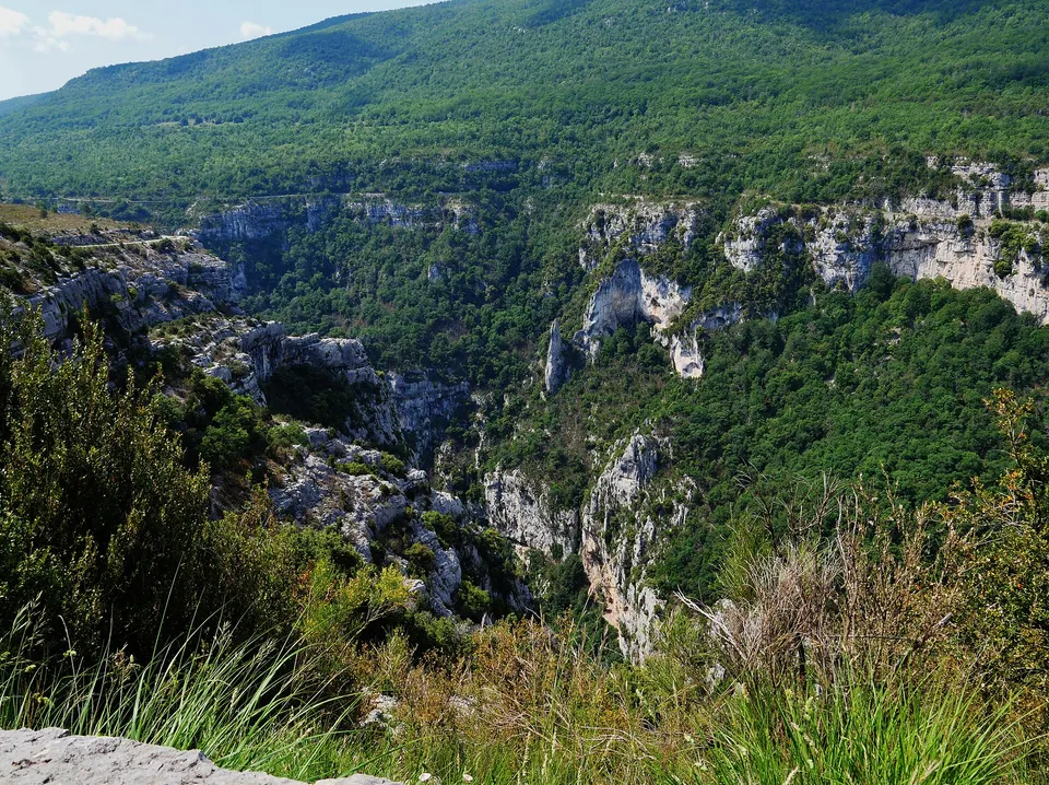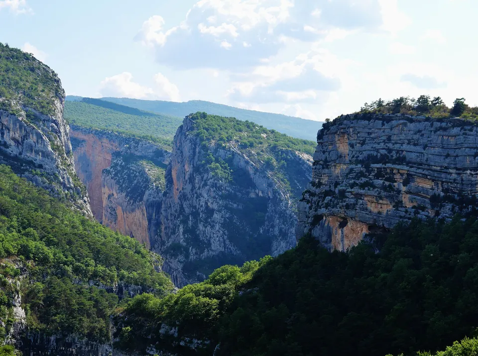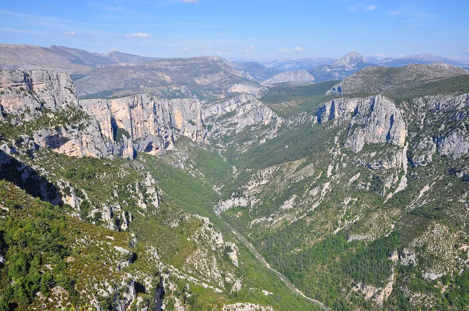
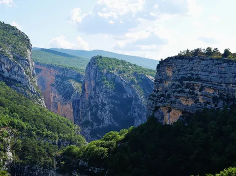
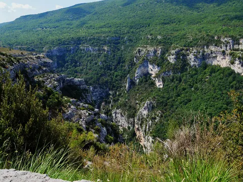
The Verdon Gorge is a canyon about 25 km long and up to 700 m deep, between the Var and the Alpes-de-Haute-Provence. From Tourtour, the mouth of the gorge at the Galetas bridge is 41 minutes away by road and La Palud-sur-Verdon, the start of the Route des Crêtes, 1 h 05. One day is enough for a driving loop: south rim via Aiguines, north rim via La Palud and the Route des Crêtes, with stops at the viewpoints and a swim in Lake Sainte-Croix.
Key facts
- The canyon: about 25 km long, up to 700 m deep.
- From Tourtour: 41 min to the Galetas bridge, 1 h 05 to La Palud.
- Route des Crêtes: 14 viewpoints, central section closed in winter.
- Protected site since 7 May 1990, at the heart of the Verdon Regional Natural Park (created in 1997).
- In one day: south rim loop, north rim, then Lake Sainte-Croix.
The Verdon Gorge in figures
The Verdon rises near the Col d’Allos and flows for about 166 km before joining the Durance. Between Castellane and Lake Sainte-Croix, it has carved the canyon that bears its name.
| Landmark | Value |
|---|---|
| Length of the gorge | about 25 km |
| Maximum depth | up to 700 m |
| Width at the top | up to 1,500 m |
| Departments | Var (south rim), Alpes-de-Haute-Provence (north rim) |
| Protection | protected site since 7 May 1990 |
| Regional natural park | created on 3 March 1997, 54 municipalities |
The explorer Édouard-Alfred Martel led the exploration of the canyon in August 1905, guided by Isidore Blanc, the schoolteacher of Rougon. The trail that bears both their names keeps their memory alive.
From Tourtour: driving times
Tourtour is a good starting point: the village lies south of Lake Sainte-Croix, on the Var side. Approximate times, excluding summer traffic.
| Destination | Distance | Time |
|---|---|---|
| Les Salles-sur-Verdon (lake) | 33 km | 37 min |
| Aiguines (south rim) | 34 km | 42 min |
| Galetas bridge (mouth of the gorge) | 37 km | 41 min |
| Moustiers-Sainte-Marie | 45 km | 50 min |
| Point Sublime | 58 km | 1 h 11 |
| La Palud-sur-Verdon (Route des Crêtes) | 59 km | 1 h 05 |
| Castellane | 64 km | 1 h 18 |
A one-day driving itinerary
Two roads follow the canyon, one on each rim. The full loop fits into a day, as long as you set off early in summer.
- Tourtour, Aups, Les Salles-sur-Verdon: reach Lake Sainte-Croix from the south.
- Aiguines and the south rim: the south rim road (D71, then D90 and D955) follows the canyon on the Var side to Castellane.
- The Artuby bridge (Pont de Chaulière), 110 m long and 140 m above the Artuby, built between 1938 and 1947.
- Castellane, the upstream gateway to the gorge.
- The north rim along the D952, Point Sublime, then La Palud-sur-Verdon.
- The Route des Crêtes, a loop of 14 viewpoints starting from La Palud.
- Moustiers-Sainte-Marie, then back via Lake Sainte-Croix and Les Salles.
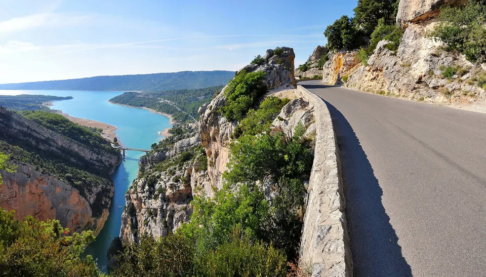
The Route des Crêtes, the canyon panorama
Starting from La Palud-sur-Verdon, the Route des Crêtes (D23) lines up 14 viewpoints over about twenty kilometres, above cliffs with drops of more than 700 m. Part of it is one-way and the central section closes every winter. Full details: the Route des Crêtes.
The gorge on foot
The Blanc-Martel trail goes down to the bottom of the canyon for about 15 km, between the Chalet de la Maline and Point Sublime, with tunnels and ladders: a full day. Other, shorter trails start from the viewpoints. See hiking in the Verdon Gorge.
The gorge on the water
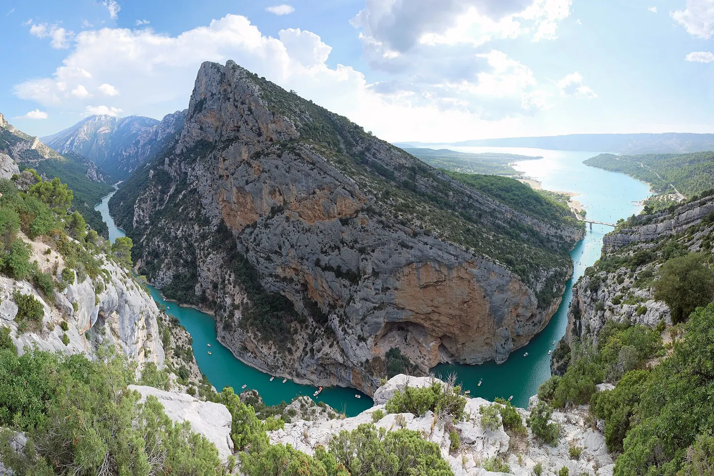
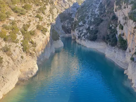
At the lower end, the Galetas bridge marks the entrance to the gorge from Lake Sainte-Croix. You can hire pedalos, canoes and electric boats there to paddle up the canyon between the cliffs. Petrol engines are banned on the lake. See kayaking in the gorge and boat hire.
Lake Sainte-Croix
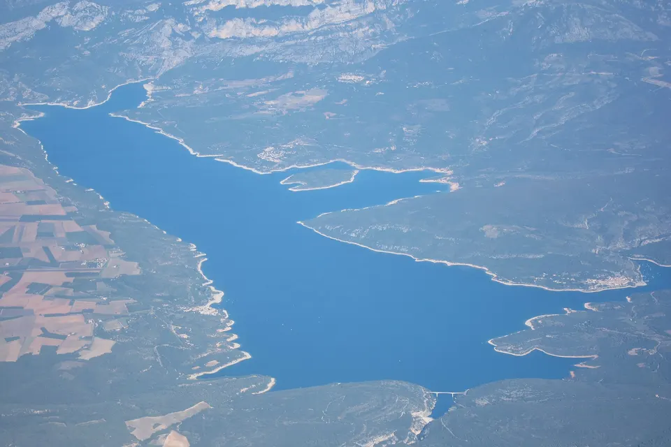
The lake, created by the Sainte-Croix dam in 1973, covers about 2,200 hectares where the gorge opens out. Lifeguarded beaches in summer, lakeside villages, water sports: see Lake Sainte-Croix.
Practical tips
- Set off early in summer: the canyon roads are narrow and the viewpoint car parks fill up quickly.
- Vehicle height: the Route des Crêtes has height limits in its tunnels (3.6 m at the sides, 4.3 m in the centre).
- Winter: check that the central section of the Route des Crêtes is open before you go.
- Wildlife: vultures, chamois and foxes can be seen from the viewpoints.
Book an activity
Tours and activities in the Verdon Gorge
 Verdon: Floating in the Grand Canyon4 hours★ 4.9 (28 reviews)from €72Check availability
 The Gorges du Verdon, departure from Moustiers-Sainte-Marie, tour and transport3.5 hours★ 4.7 (4 reviews)from €125Check availability
 Verdon Gorge: Vulture watching1.5 hours★ 5.0 (3 reviews)from €30Check availability
All activities on GetYourGuide
"From" prices checked on 8 November 2026 and may have changed.
Affiliate links: Tourtour.org earns a commission if you book, at no extra cost to you. "Show live prices" loads the GetYourGuide module, which sets its own cookies (learn more (in French)).
Frequently asked questions
How long does it take to get from Tourtour to the Verdon Gorge?
About 41 minutes to the Galetas bridge (the lower entrance to the gorge, 37 km), 1 h 05 to La Palud-sur-Verdon (59 km) and 1 h 20 to Castellane (64 km), excluding traffic.
What is the most beautiful spot in the Verdon Gorge?
The viewpoints on the Route des Crêtes, above La Palud-sur-Verdon, and Point Sublime offer the most spectacular views of the canyon. The Galetas bridge shows the gorge opening onto Lake Sainte-Croix.
Can you visit the Verdon Gorge in one day?
Yes, by car: the loop along the south rim (Aiguines) and the north rim (La Palud, Route des Crêtes) fits into a day with stops. Hikes such as the Blanc-Martel trail take a full day on their own.
Which village should you visit in the Verdon Gorge?
Moustiers-Sainte-Marie, listed among the Most Beautiful Villages of France, north of Lake Sainte-Croix. Aiguines overlooks the south rim, while La Palud-sur-Verdon and Castellane sit on the north rim and upstream.
What is an easy outing in the Verdon Gorge?
The Route des Crêtes by car, with viewpoints a few steps from the road. On the water, paddling up the gorge by pedalo or canoe from the Galetas bridge. The Blanc-Martel trail, by contrast, is a proper 15 km hike.
Sources
Information checked against the sources below. Opening times and dates change: confirm before you travel.
- Wikipedia (French), Gorges du Verdon (dimensions, roads, protected site), accessed 7 November 2026
- Provence-Alpes-Côte d'Azur regional tourist board, the Route des Crêtes, accessed 7 November 2026
- Wikipedia (French), Verdon Regional Natural Park, accessed 7 November 2026
- Wikipedia (French), Blanc-Martel trail, accessed 7 November 2026
- Travel times: OSRM routing on OpenStreetMap, from the centre of Tourtour, accessed 7 November 2026